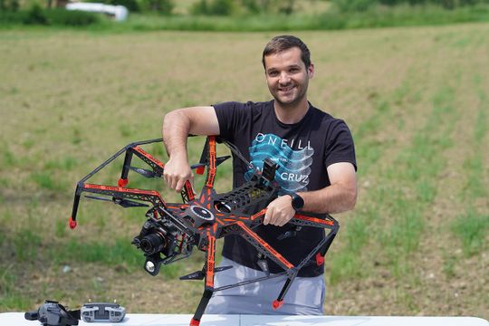
Modern structural diagnostics ensure secure bridges.
Building Owners / Asset Owners
Through digital building models, you can obtain a standardized, objective, and georeferenced overview of all relevant information. Therefore, efficient processes for digitizing a multitude of existing structures are of great importance. The significance of the results in the digital twin largely depends on the quality of data capture during inspection.
Digital inspection foundations for secure assessment of the condition result
Civil Engineer / Structural Engineer
To conduct reliable and traceable bridge assessments, you need optimally structured data. The collected data and results must be complete, of the highest quality, easily accessible, and capable of further processing without information loss. The basis for this is perfectly captured visual material to minimize your liability for the condition result.
Most accurate data for perfect data processing
Data Processor
Services such as AI-based damage detection, 3D structural modeling, and high-end visualization as a digital twin with a link to the damage report. Take your digital inspection to the next level!
Artificial intelligence handles the tedious work, allowing you to focus on the essentials. Various types of concrete damage can be easily identified by neural networks based on high-resolution images in the sub-millimeter range. Prerequisite: The quality of the images is perfect.
Only perfect image data delivers meaningful inspection results
Drone Operators / Data Capture Experts
The results of an inspection can only be as good as the data you provide it. Using drones to fly over bridges and structures not only offers the advantage of documenting areas that were previously inaccessible for inspections but also presents new challenges for you as a drone pilot. This includes ensuring a safe flight experience in areas with limited visibility and delivering sharp, well-illuminated, properly overlapped, and consistently GSD-captured images for your clients in all weather conditions.
Key features
-
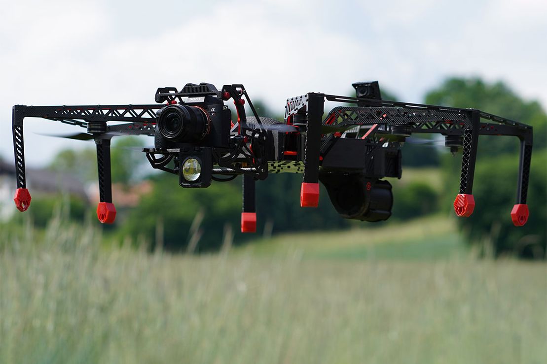
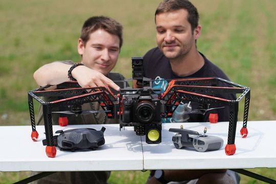
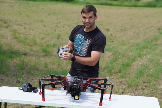
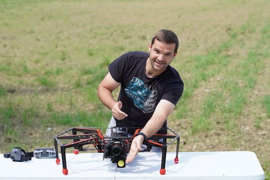
Innovative design specifically for bridge and structure inspections
-
Buy & Fly: Certified in Open C5 according to (EU) 2020/1058
-
Configured for operations in the Specific category
-
Optimal for Digital Twin and AI Damage Detection by Strucinspect
-
Payload up to 1.1 kg with a total weight under 5 kg and a UAV width less than 800 mm
-
Real GSD 0.5 mm (Ground Sampling Distance)
-
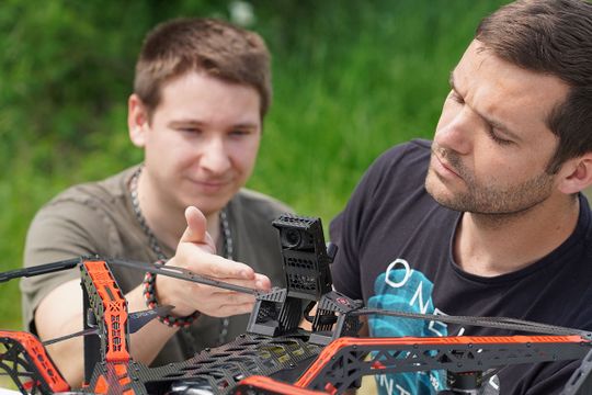
Tool Head: Vibration-dampened quick-change system for various camera setups
-
One or more cameras, e.g., GoPro, APS-C, full-frame 35mm
-
Camera tilt range: vertical +/- 90°
-
Outstanding navigation with a rear-mounted First Person View camera (FPV DJI O3)
-
Confident flight experience with sensor-independent flight control
-
Stable flight position with precise response to pilot inputs without latency
-
Real-time FPV live view with Full HD video transmission to third parties
-
Stored 4K FPV recordings for complete visualization or processing
-
Visualization of scalable depth of field with HMI (Human Machine Interface)
-
External storage of object distance for each image
-
Uniform object illumination with one or two high-performance flash modules
-
External cushioned legs for safe landings
-
Narrow wind profile
-
Mechanical propeller protection
-
Customizable battery options
-
Flyaway security with external emergency shutdown and parachute rescue system
-
Remote ID transmission system
-
High serviceability
Kochertalbrücke
-
Information about this project
Project Name:
- KOCHERTALBRÜCKE
Client:
- Implenia Switzerland AG
Project Description:
- Kochertalbrücke, (Federal Road) in Germany
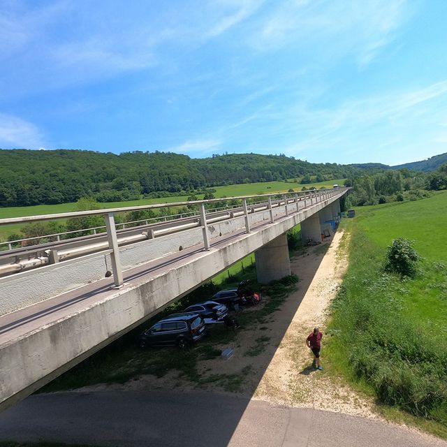
At the Kochertalbrücke, we received a contract from a large globally operating corporation. This involved the use of modern technologies to capture the structure, enabling a precise comparison between laser scanning and photogrammetry. Using a 42-megapixel sensor, we conducted the captures to generate highly accurate image data. By applying photogrammetry, we were able to demonstrate its superiority over laser scanning.
Services provided by ADP Rinner ZT GmbH
- Comprehensive flyover without the roadway using AI (0.5 mm)
- Model and georeferenced overview images
- Delivery: in accordance with PSI - data and folder structure
Key Details:
- Approx. 100m in length
- Structure Type: Box Girder
Personnel:
- DI Gerald Fuxjäger
- Michael Kulmer
- Senad Niksic
Rosenbrücke
-
Information about this project
Project Name:
- ROSENBRÜCKE
Client:
- State of Lower Austria / Smart Inspection
Project Description:
- Danube Bridge in Tulln, Lower Austria
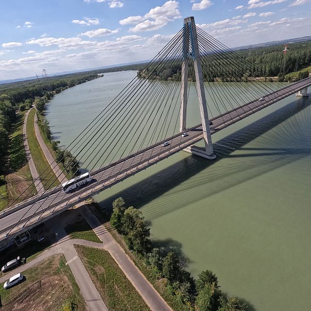
For the Rosenbrücke, we were tasked by a surveying company whose GPS-based system couldn't capture the underside of the structure. Their system couldn't "look up," and the design of the inspection machine proved to be too large for the task's requirements. The challenging job of capturing the bridge's underside was assigned to us. With our specialized equipment and specific expertise, we were able to overcome the system's limitations and successfully supplement the missing data for the Rosenbrücke. This ensured a precise and comprehensive documentation of the bridge's condition.
Services provided by ADP Rinner ZT GmbH:
- Flyover of the bridge's underside with AI model variant (GSD: 0.5mm) or model (GSD: 1.5mm) for model images
- Pylons below the roadway level for AI and model images
Key Details:
- Approx. 440m of the bridge's underside
Personnel:
- DI Gerald Fuxjäger
- Michael Kulmer
- Kevin Moik
Lingenauer Hochbrücke
-
Information about this project
Project Name:
- LINGENAUER HOCHBRÜCKE
Client:
- State of Vorarlberg / PSI
Project Description:
- L205 Hittisauer Straße, Vorarlberg
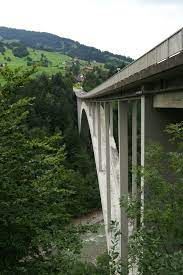
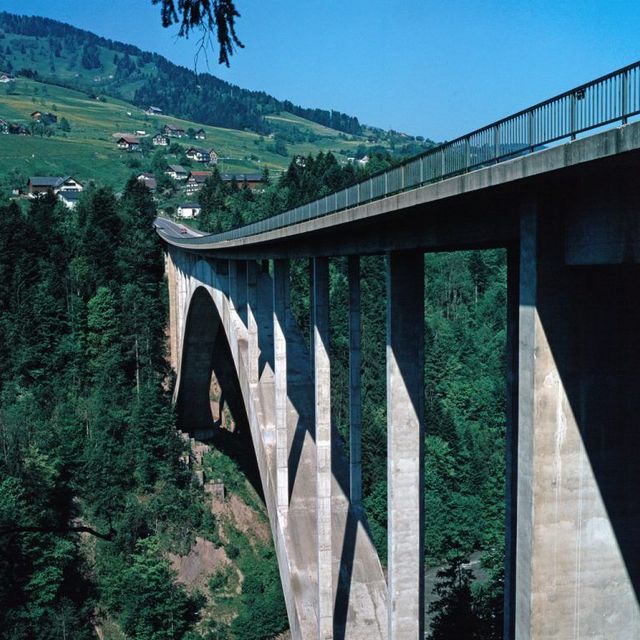
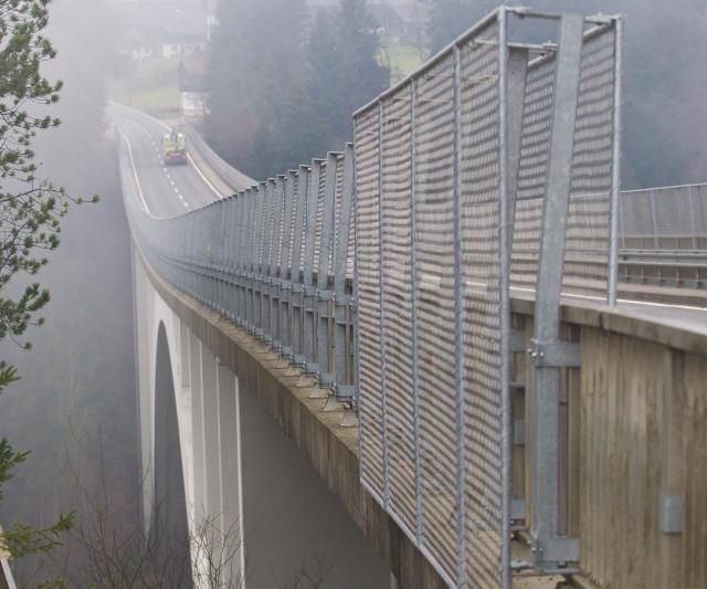
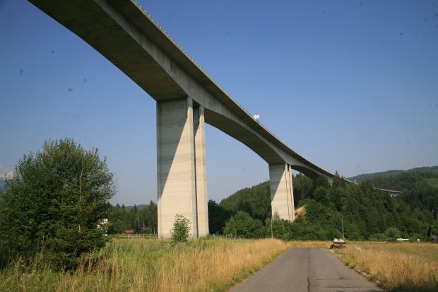
The Lingenauer Hochbrücke, with an impressive length of nearly 400 meters, was one of our largest projects to date. Its intricate construction added a unique level of complexity to the endeavor. Additionally, a continuous, massive arch spanned a river, located 70 meters below the starting point. The project was exceptionally multifaceted.
Services provided by ADP Rinner ZT GmbH:
- High-quality image capture: Set 1 - GSD 1.5/pixel with a minimum of 80% overlap, meeting general requirements for photogrammetric evaluation; Set 2 - GSD 0.5/pixel capture of the entire structure surface for damage detection
- 42-megapixel full-frame resolution; Georeferencing of images via drone GPS data
- Ground control point measurement
- Orientation of all image data and creation of a sparse cloud
- Data processing and transfer to the Strucinspect Cloud
Key Details:
- Length: 370m, Width: 10.3m, Height: 90m, Twin Track: 1
Personnel:
- DI Gerald Fuxjäger
- Michael Kulmer
- Ahmed Majdanac
- Senad Niksic
- Christopher Pintar
Palfinger Structural Inspection GmbH
-
Information about this project
Project Name:
- Structural Digitalization / Digital Bridge Inspection BW 32.1 (A99)
Client:
- Palfinger Structural Inspection GmbH
Project Description:
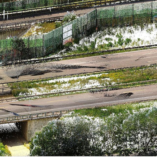
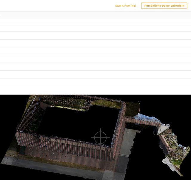
- Digitalization of the existing structure, including the surroundings (Creating a "Digital Twin")
- Comprehensive bridge inspection (condition assessment)
Services provided by ADP Rinner ZT GmbH:
- Planning and Organization
- Preparation of recording concept
- Planning of GNSS measurement
- Existing Data Capture
- Connection to the control point network (static GNSS measurement or leveling)
- Local network densification and geodetic network measurement
- Supplementary terrestrial existing data survey
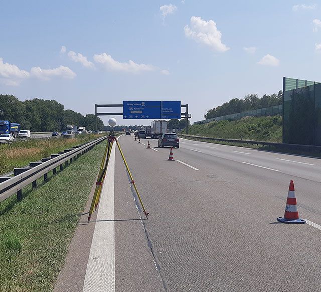
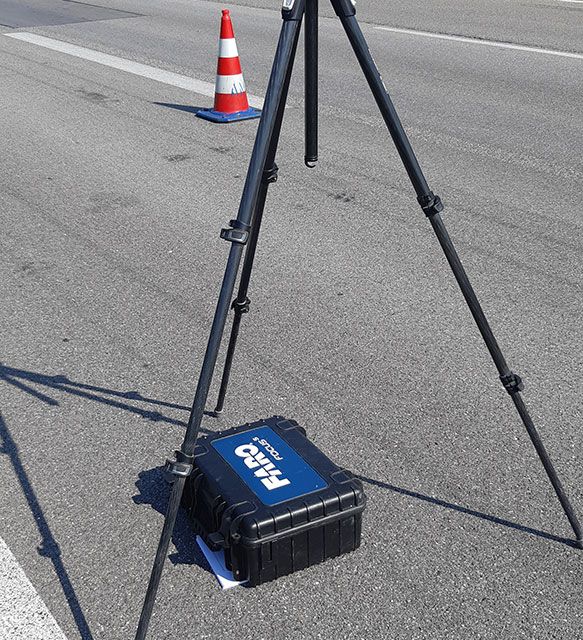
- Terrestrial Laser Scanning
- Measurement campaign planning
- Comprehensive scanning of the project area using laser scanner (approx. 30 positions)
- Recording of the bridge structure and roadway area
- Georeferencing
- Creation of a 3D point cloud as a basis for creating a BIM model
Key Details:
- A99 motorway, Aschheim near Munich, Object BW32.1
- Motorway with a total of 8 lanes, including a bridge
- Surrounding area (bypass road, access roads, etc.), approximately 4 hectares
Personnel:
- DI Christoph Pöllabauer
- Christopher Pintar
Austro Control GmbH
-
Information about this project
Project Name:
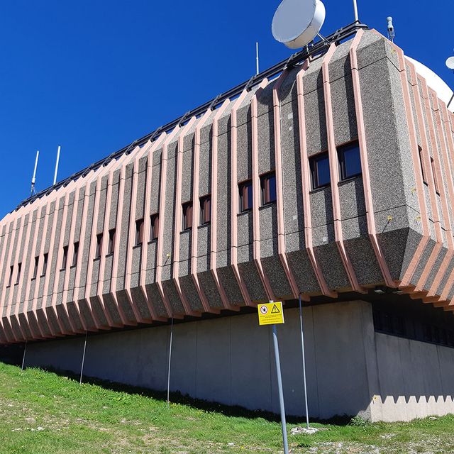
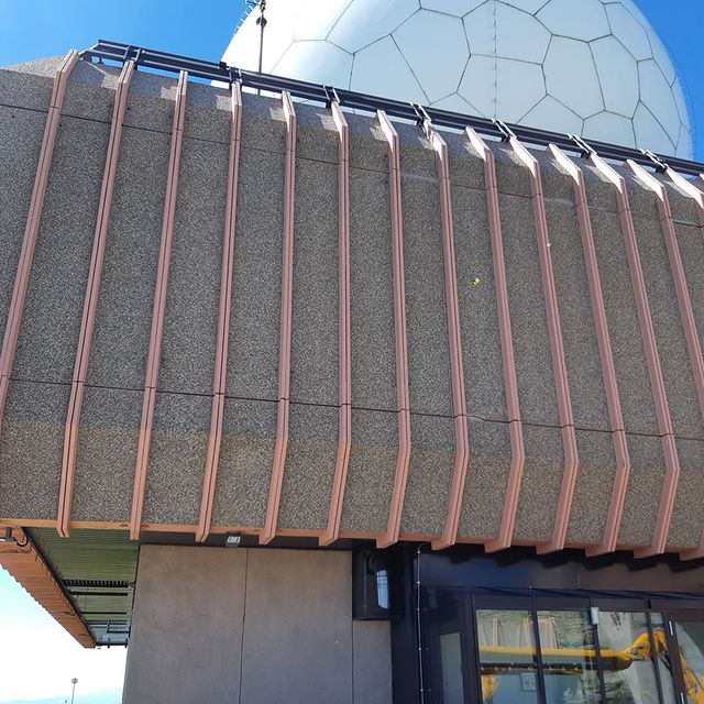
- Bauwerksinspektion MBR Koralpe
Client:
- Austro Control GmbH
Project Description:
- Installation of a measurement system for structural monitoring (deformation control)
- Repeated performance of follow-up measurements
- Condition assessment of facades and renovation
Services provided by ADP Rinner ZT GmbH:
- Planning and Organization
- Terrestrial Surveying
- Marking of control points for deformation monitoring on the facades
- Stabilization of control points
- Connection to the control point network
- Regular follow-up measurements and deformation analysis
- Facade Condition Assessment
- Photogrammetric capture of facades using drones or high-resolution terrestrial cameras
- Ground control point measurement
- Renovation of facade damage
Key Details:
- Austro Control MBR, Koralpe
- Documented facade area approximately 1500 m²
- Elevation about 2200 m
Personnel:
- DI Christoph Pöllabauer
- Michael Kulmer
Asfinag Autobahnen- und Schnellstraßen-Finanzierungs-AG
-
Information about this project
Project Name:
- Bauwerksinspektion A11 Karawankenautobahn, KA09, Talübergang Winkl
Client:
- Asfinag Bau Management GmbH
Project Description:
- Conducting a condition assessment of a structure
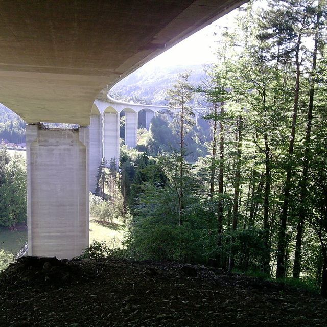
- UAV flyover of all pillars of the bridge object KA09 using drones
- Creation of high-resolution images and photogrammetric evaluations
- Generation of 3D models - "digital twins"
Services provided by ADP Rinner ZT GmbH:
- Planning and Organization
- Preparation of the flyover concept, including the selection of a suitable flying object and suitable sensors
- 3D flight planning
- Flyover
- UAV flyover of all pillars
- Capture of RGB images using a high-resolution onboard full-frame camera with a minimum of 36 MP
- Evaluation
- Detailed and georeferenced presentation of defects
- Photo documentation/damage documentation, also in editable list form
- Data delivery in a 3D visualization tool
- Delivery of an online 3D visualization tool for Asfinag and WÖRLE SPAROWITZ INGENIEURE
- Ziviltechniker GmbH for the development of the bridge's main inspection or repair concept
Key Details:
- A11, Bridge Object KA09-Valley Crossing Winkl
- Area covered approximately 20,000m²
- 8 double pillars
Personnel:
- DI Gerald Fuxjäger
- Michael Kulmer
- Senad Niksic
Contact
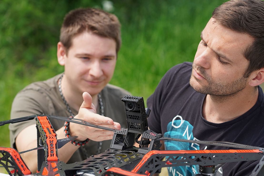
Our goal is to build the best drones for structural inspections. Early on, during the structural flyovers we conducted, we noticed that the drones available on the market couldn't deliver images of the required quality. With passion and dedication, we began to design and build our own drones. We are more than willing to share the expertise we have gained through this process with you.
Dipl.-Ing. Gerald Fuxjäger
Managing Partner CEO
Consulting Engineer for Surveying and Geoinformation
Lecturer at Graz University of Technology
Judicially sworn and certified expert in photogrammetry, remote sensing, GIS, and real estate.
Downloads
Here, you will have access to various downloads such as user manuals and updates in the future.
Training
Meet the minimum requirements as a pilot or observer and obtain the SCORPIO MK II Flight Competency Certificate to demonstrate your flight competence. Our certificate course is time-efficient and flexible, available both on-site and online. Complete the training and tests within a day and secure the authorization to operate the SCORPIO MK II.


